Myself and Steve parked up on A591 just down from The Travellers Rest, Grasmere and commented on the weather not being as clear as it had been when passing Keswick. Still, it was not forecast to rain and it was mild in temperature, though vision limited.

The view from the road toward Stone Arthur.

A dozen Herdwick Rams in the above field.

Looking back after a thankfully dry crossing, well, Holly(The Beast) swam it as usual.
This track, initially easy to follow petered out into a quagmire route of peat and reeds; it eventually took constant checking of our Satellite mapping system to ensure we were on the marked path. The weather was unduly mild and although we were prepared for anything I stripped to T shirt, Steve ended up bare chested and we had to laugh at how we were now dressed compared to our last three rain lashed outings.
We made the summit of Calf Crag in good time so I asked Steve to take an 'I was here' shot of me at the cairn


Someones paying attention, I wonder why?

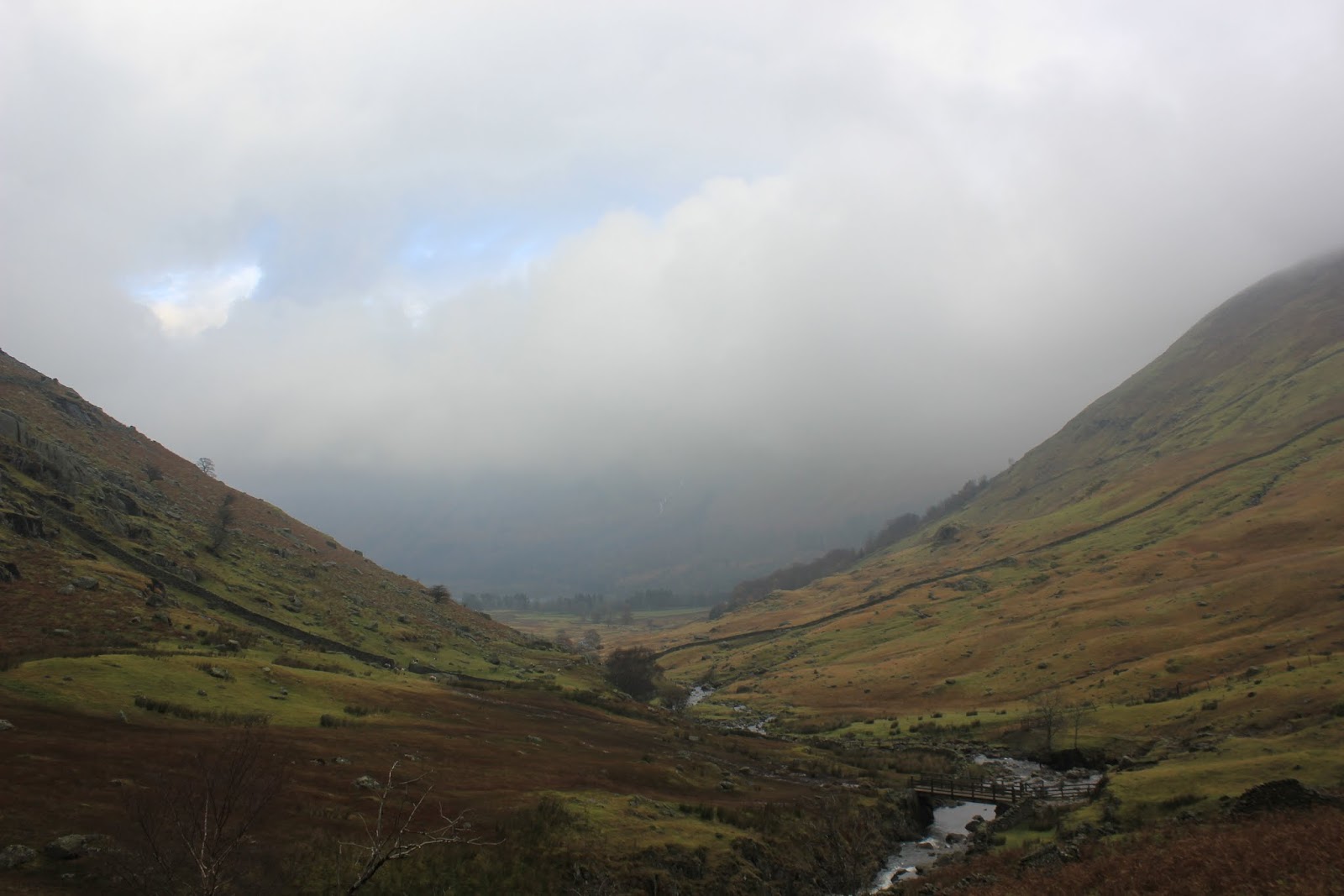
At this point this was regarded as a brilliant view.

Greenup Edge opening up.

On Greenup Edge looking to Stonethwaite area. Fleetwith Pike with it's distinctive steep slope where they have the Via Ferrata.

Low cloud, masking that which is The Bog.

Wythburn Tarn at The Bog's end.

Looking back on an area that I'll only do again in a dry summer, preferably a drought.
The view down to Wythburn

Lookingt back on the waterfalls.
We baited at the footbridge where the two footpaths from Stockhow Bridge meet and decided to alter our plan of going round to Dunmail Raise via footpaths and instead changed to one of them 'as the crow flies' routes straight up from the bridge. This meant a steep incline and I was panting a little by the time we got to the summit There we were with only a downhill section to come, this had meant that having left the clag behind we were back in it again. This route taxed the Achilles tendons but we're used to that now.

Nearing Steel Fell summit, the most sun seen all day.

Dylan on the summit. The boy done good, Holly is off around somewhere on one of her 'missile speed' sorties.
The path off Steel Fell back to Greenburn Bottom was tricky to find and we referred to the electronic mapping systems to locate a point where it is worn. Once on it you can't really go wrong, well not navigationally, but if I slipped once on this grassy descent I slipped a dozen times and was very concious of knee ligaments. Even Steve, normally sure footed found it hard to keep upright. We got down with no lasting damage done, just some muddy washing for our wives to tackle. We linked up with our original route and got to the car, a quick roadside change and it was into Grasmere for Tweedies Bar (part of The Dale Lodge Hotel) and some quality beers. I had a Coniston Brewery K7 and a Red something or other which I can't remember it's full name. Both were top quality drinks and I could drink either one all night.

A good outing in mild though misty weather of 16kms with 1050m ascent. I didn't know the routes before, now I do and interesting that they were I'll return when it is a dry summer.
Never mind the Wainwrights - I think it's high time for a book of Ray's Routes! Avoid the bogs though please :-)
ReplyDeleteThat is very kind of you to say Karen. I could call it 'I Wandered Lonely as a Cloud', that is, if it hasn't been used before. :o)
ReplyDelete